PLAN VIRTUALLY AND BUILD WITH SUCCESS
Accelerate the planning stage of your projects and turn your concepts into actionable designs — right from your desk.
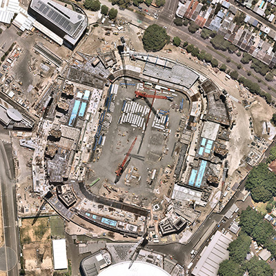
2017 | 2019 | 2021 | ST PETERS, NSW AU
FREQUENT CAPTURES
Stay on top of change and keep teams informed with aerial imagery that’s refreshed up to 6 times per year*
WIDE COVERAGE
Have confidence that your project site is covered with coverage that spans 90% of Australia’s population
RICH PRODUCT STACK
Go beyond top-down views with a rich stack of premium content, including 3D and oblique
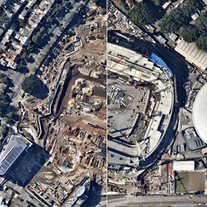
HISTORICAL DATA
Understand how an area has evolved over time with captures dating back to 2009
COMPATIBLE WITH


Level 4, Tower One
100 Barangaroo Avenue
Barangaroo, NSW 2000
☎ 1800 632 762

1850 Ashton Blvd
Suite 500
Lehi, UT 84043
☎ 1-844-463-2762