 NEARMAP AI DATASETS

NEARMAP PARTNERS
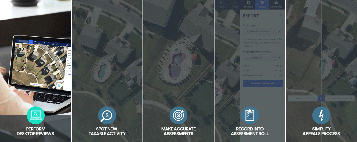
Content Tailored for Assessors
There's a better way to review properties in greater detail during property assessment. Make Nearmap a part of your day-to-day activities to easily spot new taxable items, make accurate property valuations, verify parcel data, and simplify the appeals process. Be confident in your decision-making with Nearmap Oblique and Vertical imagery, to remotely view the property in question from all angles, without ever setting foot on the ground.
Get a more streamlined, stress-free approach to budgeting, procuring, and implementing aerial content compared to the traditional way with a robust library of aerial content from Nearmap. With cloud-based imagery that is proactively captured up to 3 times a year - and made readily available, you can instantly stream Nearmap Oblique, AI, and Vertical content, all at the click of a button.
 |
 |
 |
|
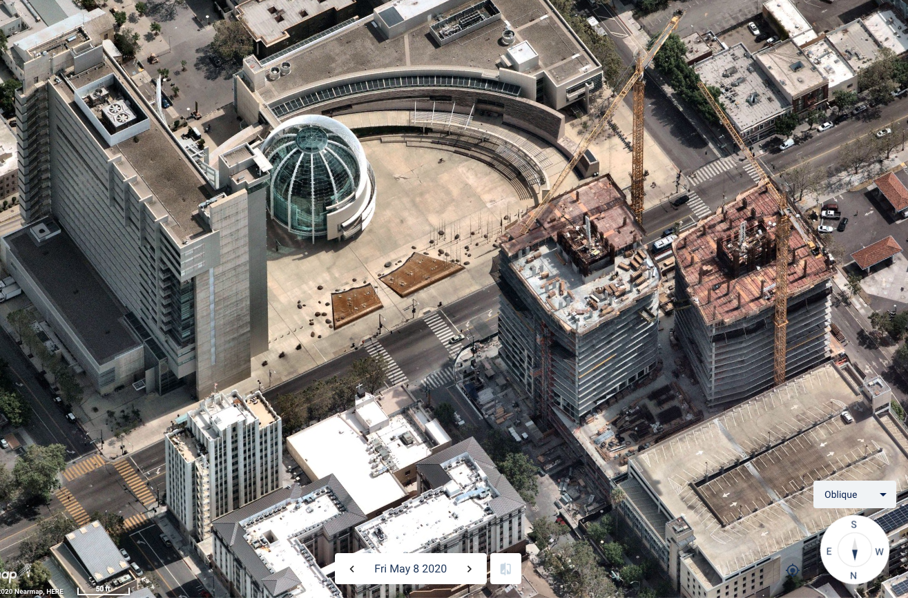
OBLIQUE
|
NEARMAP ARTIFICIAL
INTELLIGENCE (AI) DATASETS |
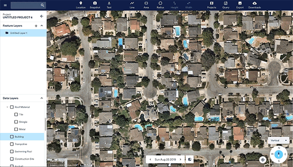
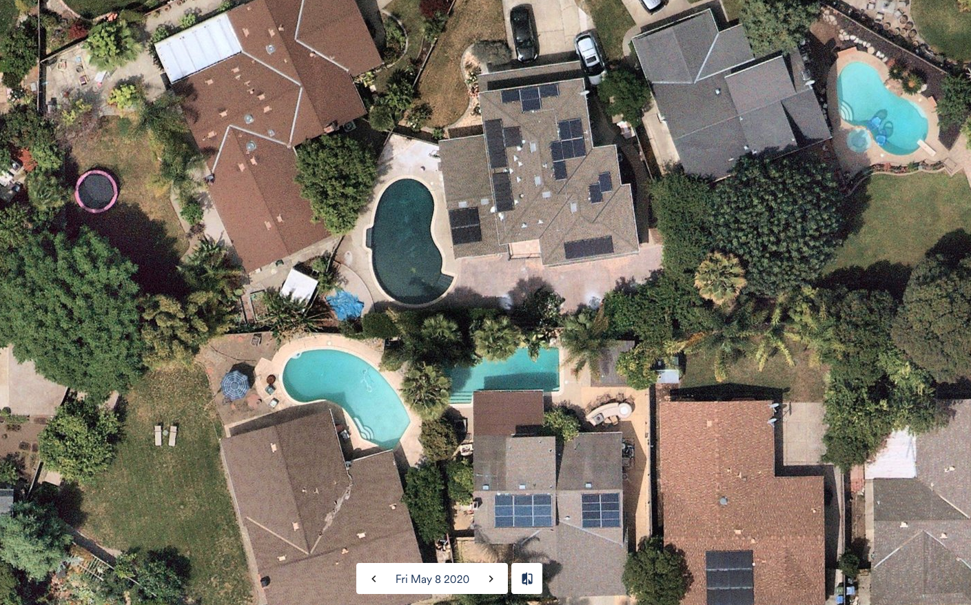
VERTICAL
|
|
|
|
Excepteur sint occaecat cupidatat non proident
Lorem ipsum dolor sit amet, consectetur adipiscing elit, sed do eiusmod tempor incididunt ut labore et dolore magna aliqua. Ut enim ad minim veniam.
CONTENT TAILORED FOR ASSESSORS
NEARMAP PARTNERS
Excepteur sint occaecat cupidatat non proident
Lorem ipsum dolor sit amet, consectetur adipiscing elit, sed do eiusmod tempor incididunt ut labore et dolore magna aliqua. Ut enim ad minim veniam.

Lorem ipsum dolor
Lorem ipsum dolor sit amet, consectetur adipiscing elit, sed do eiusmod tempor incididunt ut labore et dolore magna aliqua. Ut enim ad minim veniam.
Lorem ipsum dolor
Lorem ipsum dolor sit amet, consectetur adipiscing elit, sed do eiusmod tempor incididunt ut labore et dolore magna aliqua. Ut enim ad minim veniam.
Lorem ipsum dolor
Lorem ipsum dolor sit amet, consectetur adipiscing elit, sed do eiusmod tempor incididunt ut labore et dolore magna aliqua. Ut enim ad minim veniam.
Lorem ipsum dolor
Lorem ipsum dolor sit amet, consectetur adipiscing elit, sed do eiusmod tempor incididunt ut labore et dolore magna aliqua. Ut enim ad minim veniam.
SIMPLIFY YOUR ASSESSMENT WORKFLOWS
Get a more streamlined, stress-free approach to budgeting, procuring, and implementing aerial content compared to the traditional way with a robust library of aerial content from Nearmap. With cloud-based imagery that is proactively captured up to 3 times a year - and made readily available, you can instantly stream Nearmap Oblique, AI, and Vertical content, all at the click of a button.
BETTER VIEWS, QUICKER ASSESSMENTS
|
|
|
|
OBLIQUE
|
NEARMAP ARTIFICIAL
INTELLIGENCE (AI) DATASETS |
VERTICAL
|
|
|
|
TESTIMONIAL
 Chris Wilcock - Chief Assessor of Melrose, Massachusetts
 Trisha Favulli - Director of Assessing, Town of Falmouth
10897 S River Front Pkwy
Suite 150
South Jordan, UT 84095
☎ 1-844-463-2762
Privacy Policy | Terms of Use | Contact Us