WHY NEARMAP?
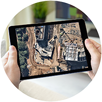
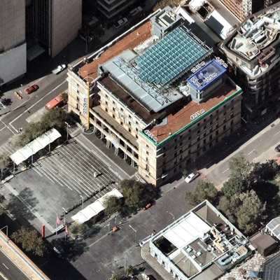
HIGH RESOLUTION AERIAL IMAGES
Use our frequently updated images for a wide variety of applications. Accurately measure areas and distances, track changes over time, and inspect sites without the need for in person visits. Save time and communicate clearly with high quality aerial imagery and powerful data overlays.
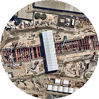
TRACK CHANGES OVER TIME
Save time on site visits and see how your development site changes by effectively monitoring projects to ensure they're on track. This minimises risks and simplifies project management.
TRANSFORM THE WAY YOU WORK
Visit sites remotely to accurately survey, measure, and gain insights you wouldn’t discover in person. Harness location intelligence with our comprehensive set of data and analytical tools. And redirect all that saved time to other priorities.
BID JOBS SMARTER & FASTER
Anytime, anywhere access to current, accurate aerial views means you save time and money — and skip the road rage — by inspecting and monitoring locations on our cloud-based platform.
CAPTURED FROM THE AIR, GROUNDED IN THE TRUTH
VERTICAL
An orthogonal imagery base layer. Get a crystal-clear, top-down view that's updated regularly. Measure line, area, and radius, and export high-res images.

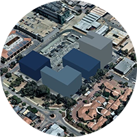
3D
Explore our entire Australian 3D catalogue inside a lightweight web app, and download high-res 3D datasets of your AOI in just a few hours.
OBLIQUE
View the sides of buildings and other ground features. Measure building height and roof pitch & area, and get a rich contextual understanding of your location.

Level 4, Tower One
100 Barangaroo Avenue
Barangaroo, NSW 2000
☎ 1800 632 762
10897 S River Front Pkwy
Suite 150
South Jordan, UT 84095
☎ 1-844-463-2762